
Returning from my stay in Lorraine, I crossed the Jura mountains to return to my Alps in Savoy. On the way there, we passed through Switzerland via Vallorbe and Pontarlier. On the return, a change of itinerary. From Besançon, we reached Geneva via the famous Col de la Faucille.
And if you are lucky enough to have the same weather as me, you will discover a spectacular panorama.
Indeed, the Col de la Faucille offers some of the finest views of Lake Geneva and Haute-Savoie and is the perfect introduction to the Alps.
The Col de la Faucille: A Strategic Location
The Col de la Faucille, what a funny name, you might say!
In fact, it’s pretty simple to explain. From the shores of Lake Geneva, its silhouette seems to draw a sickle.
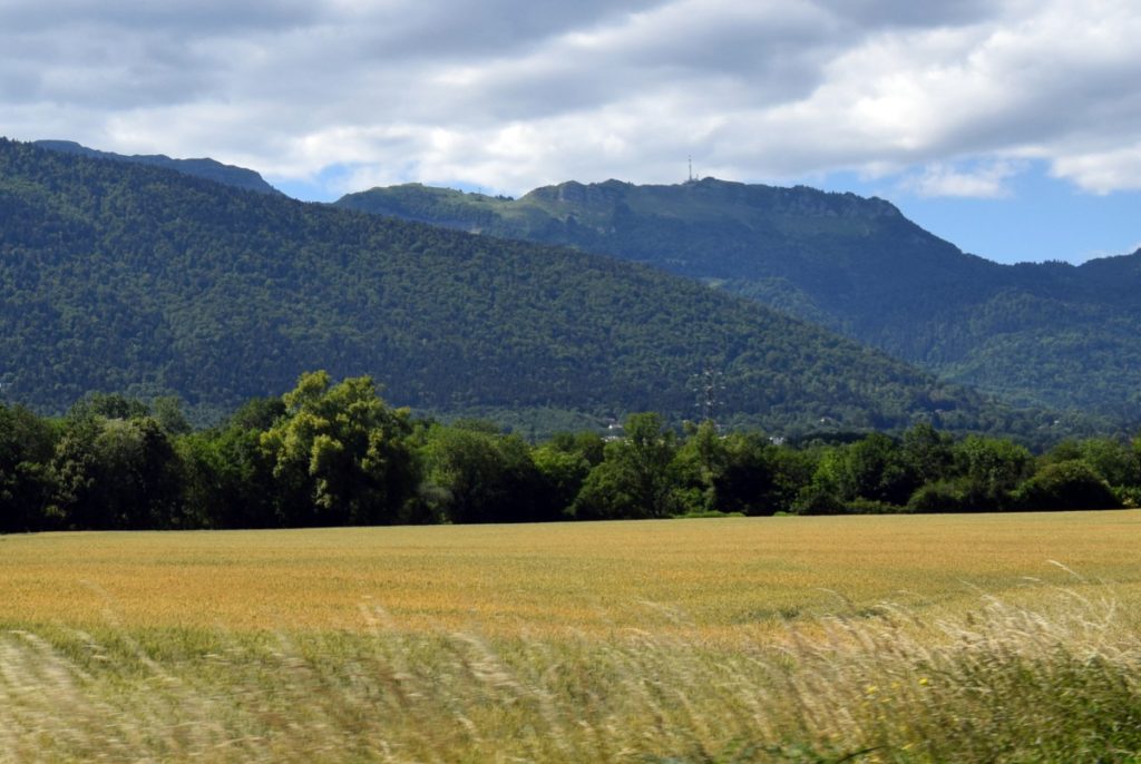
It peaks at 1,323 meters above sea level and is entirely located in the Ain department [01]. Therefore, we are at the edge of the Auvergne-Rhône-Alpes region, on the territory of the communes of Mijoux and Gex.
Although it does not mark a regional or international border, the mountain pass remains nonetheless a strategic site of prime importance.
On the Mijoux side, the Jura mountains are characterized by their folded chains that extend further west onto plateaus (Pontarlier, Champagnole). The Franche-Comté is very close.
On the Gex side, the Jura forms a high, steep wall dominating the entire Lake Geneva basin. Switzerland is within sight!
On the Former Route of the N5
Stretching 567 km, the national road 5 connected Paris to St. Gingolph on the Swiss border. It crossed the cities of Sens, Dijon, Dôle, and Thonon-les-Bains via Geneva. It was downgraded in 2006 over long sections, notably at the Col de la Faucille, between Les Rousses and Geneva.
From Les Rousses, the road passes close to the Franco-Swiss border at La Cure. From there, you can enjoy beautiful views of La Dôle (1677 m) and its white radome in Swiss territory.

The road to the pass overlooks the Valserine Valley, also known as Val Mijoux.
Approaching the pass, one dominates the valley by some 300 meters.
The Col de la Faucille
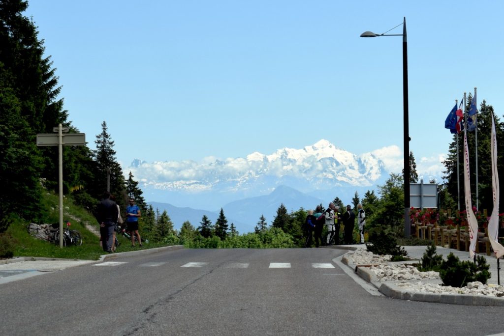
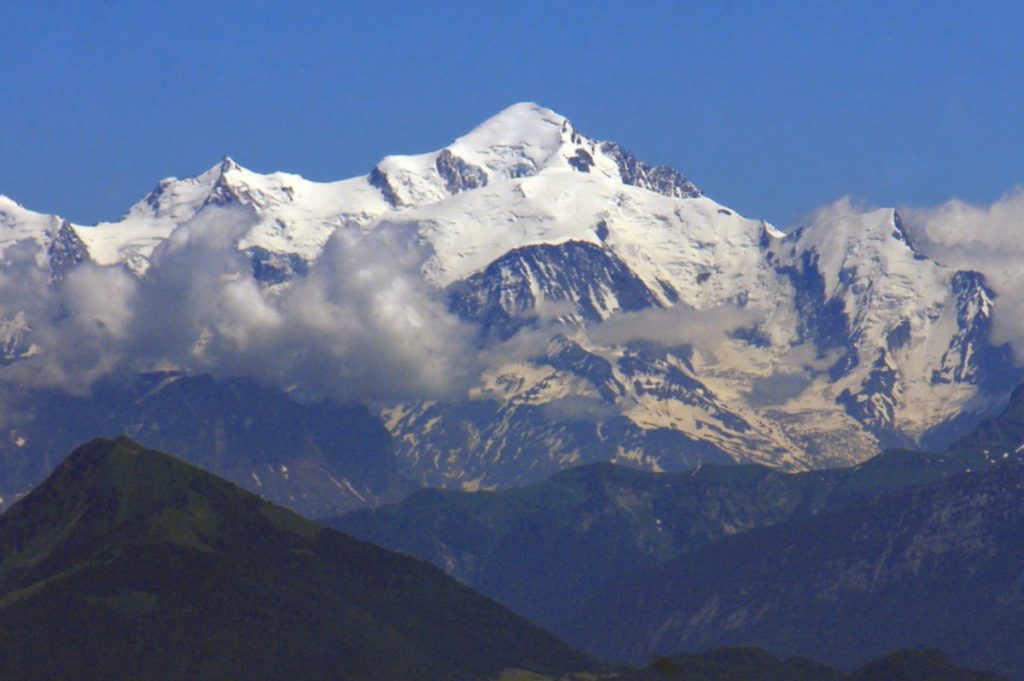
Upon arriving at the Col de la Faucille, one cannot help but cry out surprise and admiration at the sight of Mont Blanc, right in the axis!
The pass has been urbanized for a long time (accommodations, restaurants, ski lifts…). I advise you to continue on the road to discover the most beautiful viewpoints.
If you have the time (and the courage!), park at the pass and continue the climb on foot (about 2km) to Mont-Rond. From there, nothing will obstruct the view of the Alps! (ski lifts are in operation in summer)
Before hitting the road again, a little anecdote: the Tour de France has climbed the Col de la Faucille 41 times between 1911 and 2004.
The descent and sublime viewpoints
But hey, when you’re just passing through like me, you settle for the viewpoints below the pass. If the traffic isn’t too heavy, it’s quite easy to park your vehicle for a photo break!
The best-equipped viewpoint on the road is found on the second hairpin turn descending from the pass on the Gex side.
The view extends far over Greater Geneva and the Salève (above which one can recognize the peak of La Tournette (2351 m) dominating Lake Annecy):

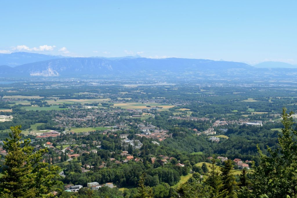
Lake Geneva appears surprisingly truncated (it looks like a wide river). One can see the peninsula of Yvoire in Haute-Savoie and the Gulf of Coudrée whose shores host the conurbation of Thonon-les-Bains.
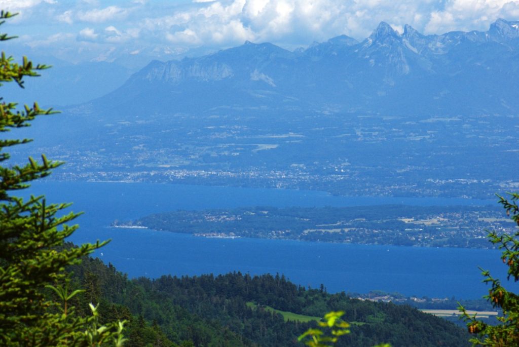


The Dent d’Oche (2222 m) and the Chablais Prealps are clearly visible.
Finally, in front of us, Mont Blanc (4810 m) rises majestically, preceded by Les Voirons (1480 m), Le Môle (1863 m), and the Aravis range (Pointe Percée, 2752 m).
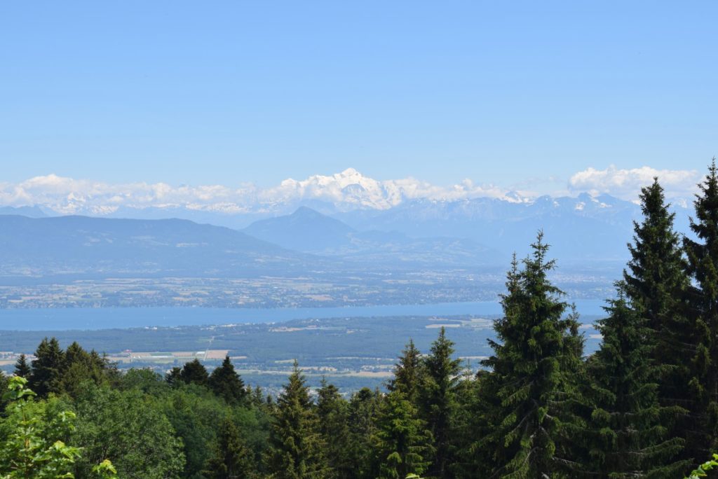
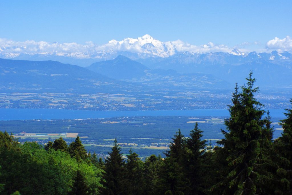
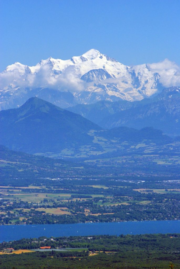
Perfect visibility, subject to suitable weather conditions!
I’ve crossed the pass several times, often in summer when visibility wasn’t excellent. A kind of haze (pollution?) enveloped the Lake Geneva basin, barely letting the peaks of the Alps appear. The weather was clear this time despite some clouds forming over the Alpine massifs.
In winter, a sea of clouds often covers Lake Geneva. Above it, the snow-capped peaks of the Alps are then very distinctly outlined.
An orientation table helps to identify the prominent peaks of the Alps.
The Napoleon Fountain
You will see the famous Napoleon Fountain in the bend at the third hairpin turn. It was named in honour of the emperor who ordered the construction of the road in the year of his coronation in 1805.
![Fontaine Napoléon © Brücke-Osteuropa – licence [CC0] from Wikimedia Commons](https://frenchalpsguide.com/wp-content/uploads/2024/03/Fontaine-Napoleon-©-Brucke-Osteuropa-licence-CC0-from-Wikimedia-Commons-1024x685.jpg)
Located at 1047 meters above sea level, it provides drinkable and freshwater that quenches the thirst of cyclists undertaking the ascent in summer! For a little anecdote, Napoleon Bonaparte never set foot in the Jura… he deserved a little fountain named in his honour!
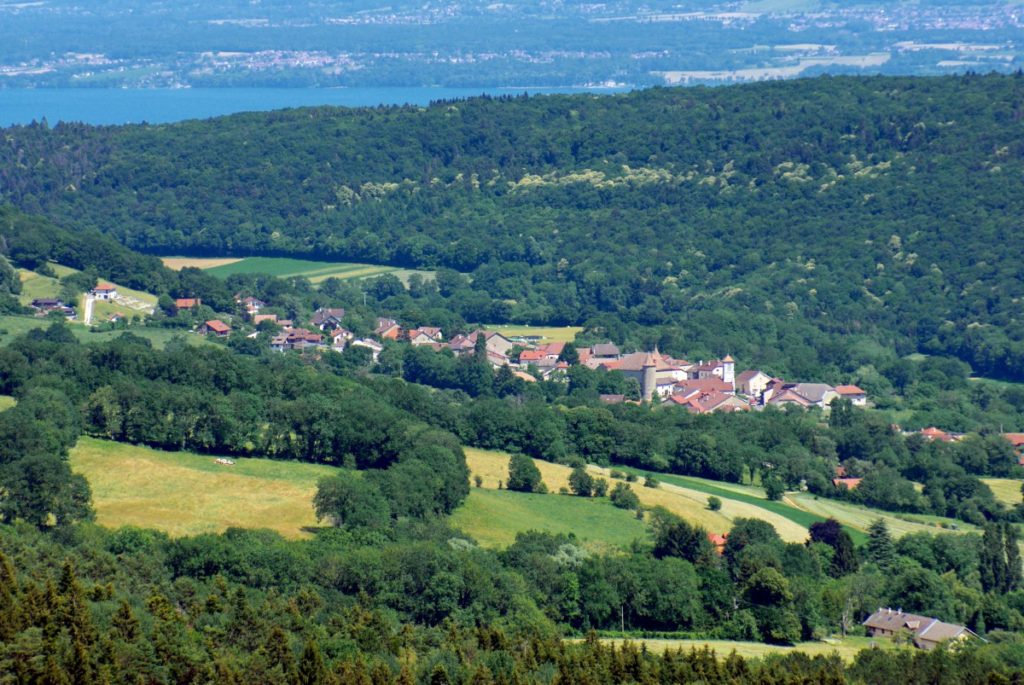
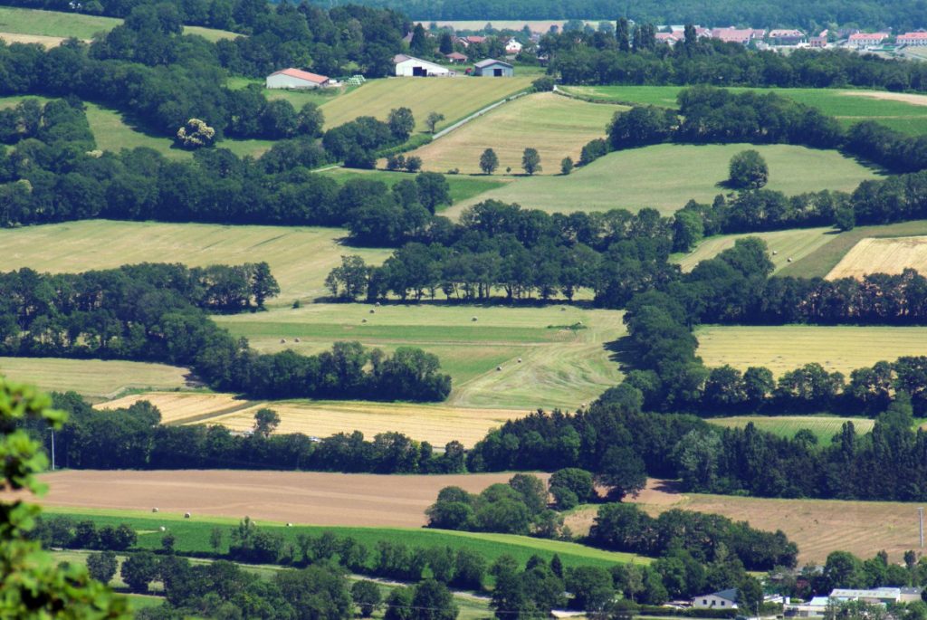
Shortly after, the road offers a breathtaking panorama of the Pays de Gex, Lake Geneva, and the Geneva conurbation. One admires a true garden: hedgerows, orchards, fields, forests, meadows… against the majestic Alps!
Gex and the Free Zone

In the past, a customs post operated at the Col de la Faucille.
The reason?
Since Voltaire’s time, the Pays de Gex has been a curious little piece of land separated from the rest of France by the mountainous wall of the Jura to the West. Thus, it has been subject to a special customs regime for over 200 years.
This free zone concerns the inhabitants of the Pays de Gex (the Gessians). It applies to all products of foreign origin.
Thus, the free zone still allows Gessian farmers to sell their production in Switzerland and to be exempt from duties within the limit of annual quotas. Moreover, it also allows the inhabitants of the Pays de Gex to buy cars manufactured outside the European Union duty-free.
A Free Zone No Longer Very Useful…
That said, with the establishment of the International Trade Organization (whose headquarters are very close, in … Geneva!) and the free trade agreements between the EU and the Swiss Confederation, the privileges of the free zone have practically lost all their interest.
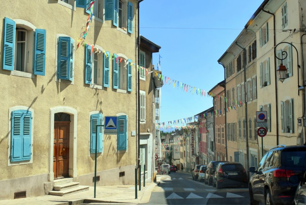
Well, if you’re still in ‘tourist’ mode, make a small stop in Gex to discover its city centre with colourful facades.
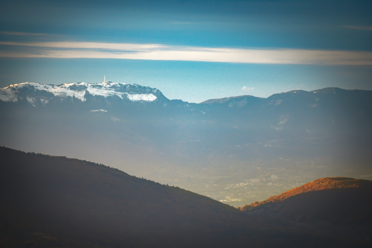
The Col de la Faucille Seen… from the Alps!
We are used to representing the Col de la Faucille, seen from the Geneva basin but rarely from the Alps.
Here is a photo taken from the village of Orange (municipality of La Roche-sur-Foron, Haute-Savoie), which clearly shows the pass in the background of a V formed by the Grand and Petit Salève. The city of Gex can be seen at the foot of the Jura mountains.

To Learn More About the Col de la Faucille
Some sites to learn more about the destination:
- The Tourist Board of the Pays de Gex
- Lake Geneva in 10 Must-See Destinations
- Lake Annecy
- Find your accommodation in the Pays de Gex here
If you find that my articles please you or have been of service, do not hesitate to share them on Twitter or Facebook. It would make me very happy and motivate me to continue writing more! 🙂
Inspired? Pin on Pinterest:

